Cascade Pass Trail in the North Cascades National Park

Cascade Pass Trail in the North Cascades National Park

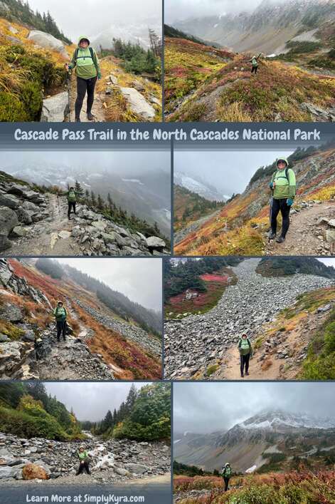
I hiked Cascade Pass Trail back at the end of September 2023 and took so many amazing photos that I wanted to share some of them with you in case you'd also love to come along on this adventure.

Pinterest geared collage consisting of eight images all including me and the landscape at Cascade Pass Trail. All images can be found below. The collage image also include the blog title and my main URL.

Good to Know

The Cascade Pass Trail is part of North Cascades National Park and doesn't require an entrance pass. That said, I wanted to share their fees and passes page in case you want to read more about the backcountry permit camping, northwest forest pass, or the dock permit.

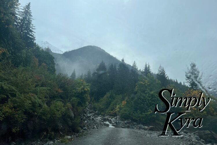
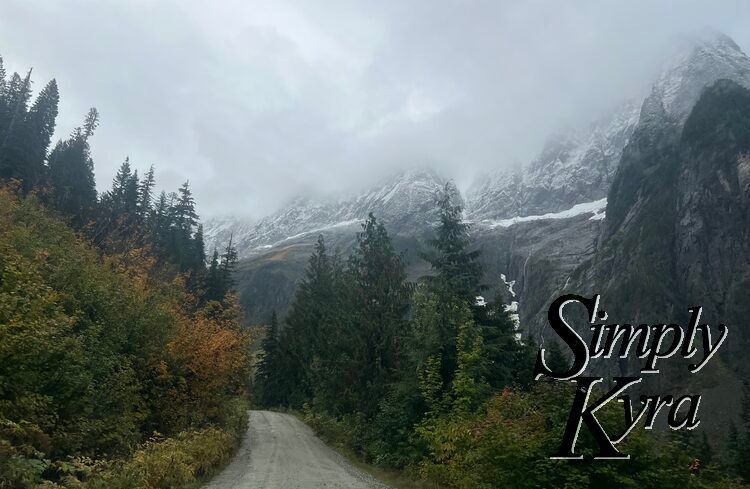
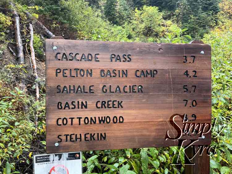
If you do go to this trail just know that the last 23 miles of Cascade River Road switches from paved to gravel and back many times and also featured a bit of fallen rocks, blown over trees, and steep sections. I can't remember exactly for how long but the last while was just a single lane and so we were really glad not to encounter another vehicle while we were driving on it. That said, the road itself offered so many gorgeous views that we joked that that was all we needed when we reached the trailhead just after 8:30 on a Thursday morning. We were also happy to see that there were two unisex vaulted toilets there. I didn't check it out but there was also a sign saying toilet pointing to a set of steep rock stairs going up the hill at the end of the Cascade Pass Trail.

On the way there we had noticed all the campgrounds were closed and after the fact saw online, through WTA, that that and the lack of picnic tables at the trailhead were because of recent incidents of bears obtaining human food rewards from improper food storage. As such you're supposed to avoid stopping and eating along Cascade River Road and the trailhead while also storing your food properly.

Additionally, my cell signal also dropped out sometime before reaching the park and stayed gone until well after we left so be sure to download or print your hiking map ahead of time and be prepared to drive out of the park without your directions connected. That said, it's also a simple road so we weren't too worried about making a wrong turn when leaving.

Cascade Pass Trail

If you're looking to do this hike yourself here's the link for Washington Trails Association (WTA) and another version through AllTrails. Now onto our adventure... in the order in which it was taken!

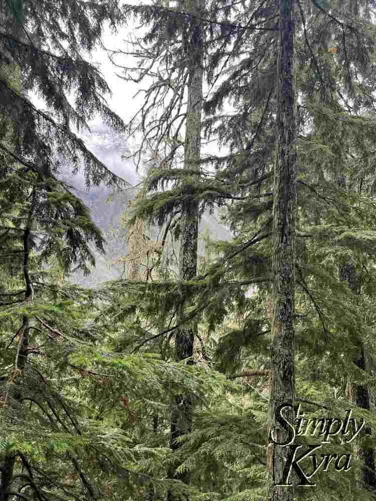
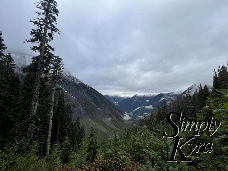
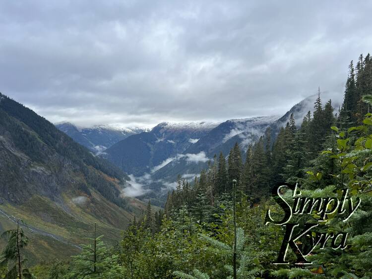
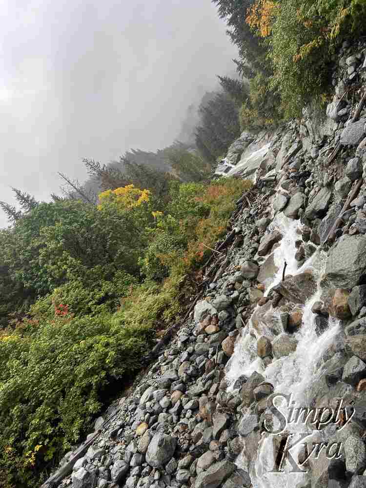
Road to the Trailhead

As we got closer to the Cascade Pass trailhead the scenery got better and better. Here are some photos I snapped through the side and front windshields on the way.
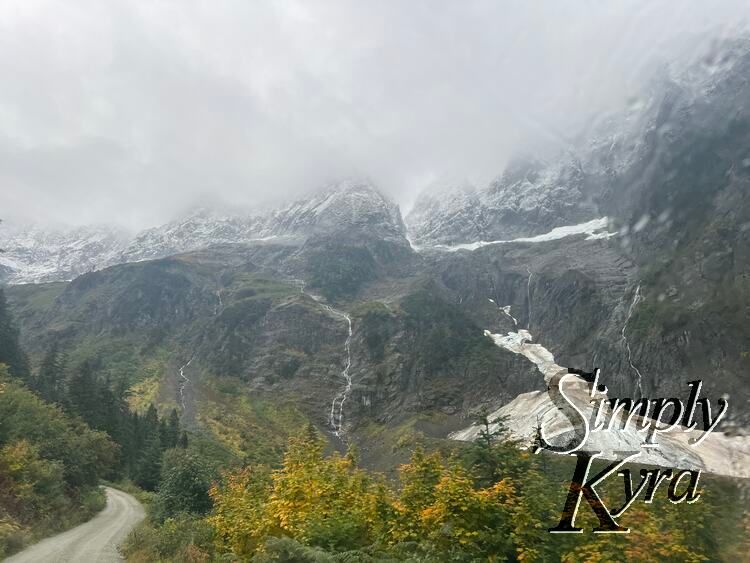
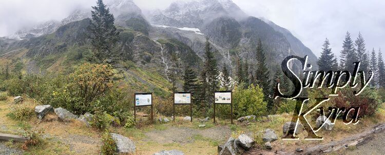
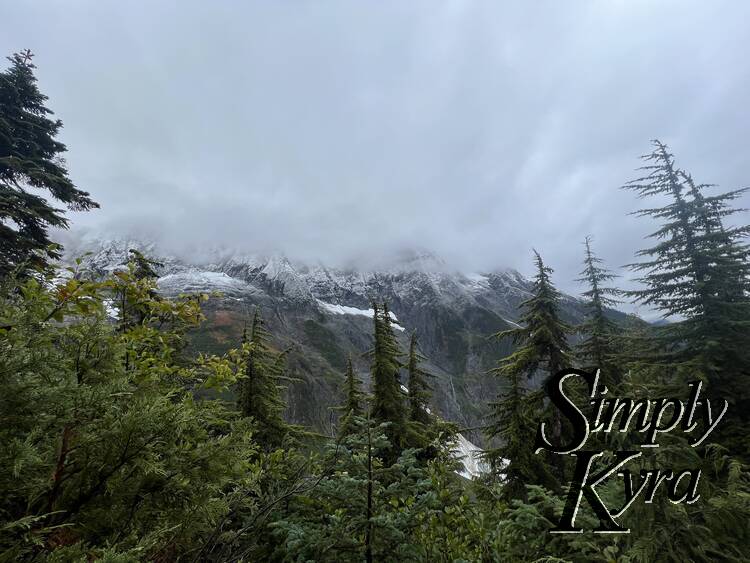
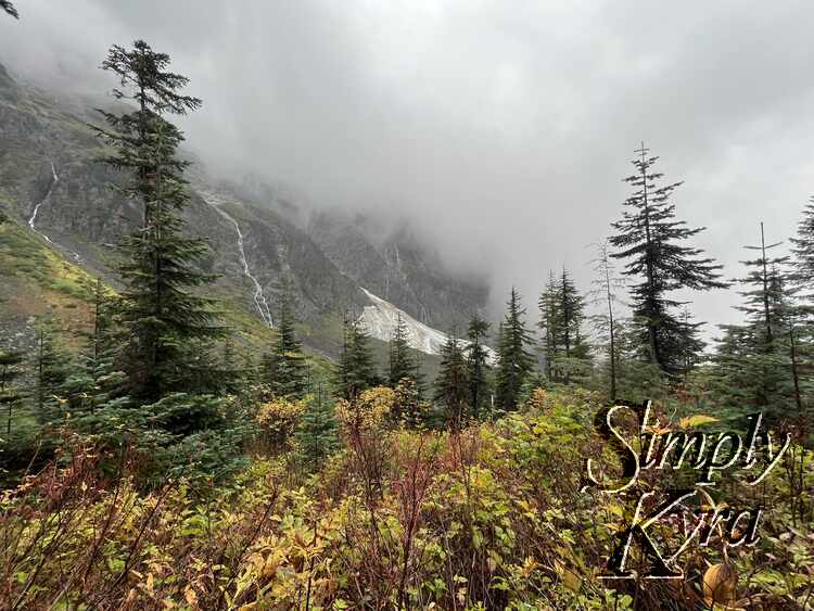
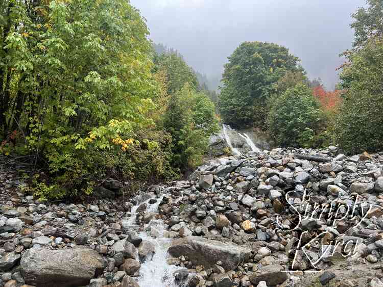
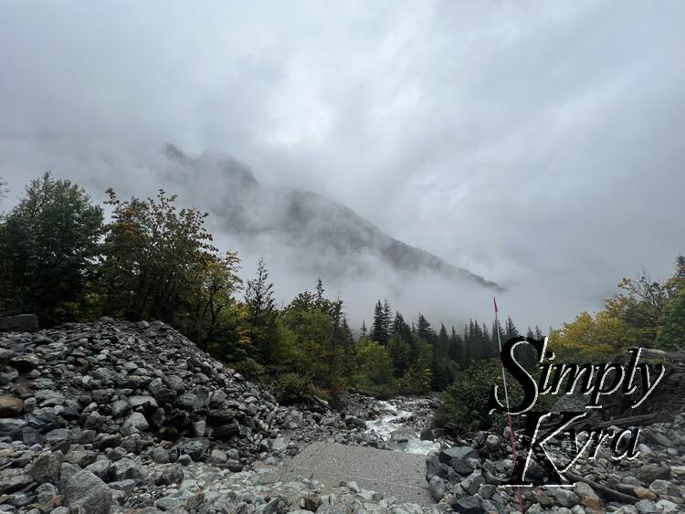
Photo of the mountain wreathed in fog in the background with a stream and trees surrounding the road.
Image of the single lane road surrounded in trees with snow capped fog strewn mountains to the right.
Image of the road to the left with trees in the foreground, glacier in the mid ground, and mountains in the background.

The Trailhead

The trailhead itself was gorgeous showing a glacier, waterfalls, and epic scenery. There are some informational posters that I just realized I never took the time to read along with two gender-neutral vaulted toilet stalls with, at that time, toilet paper and hand sanitizer.
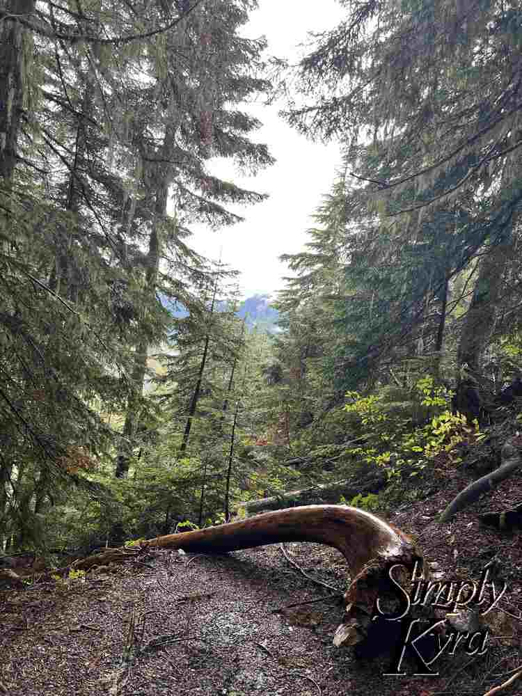
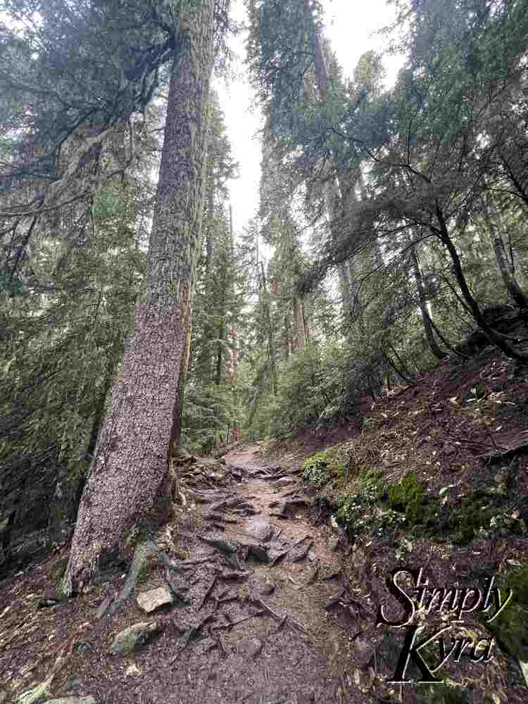
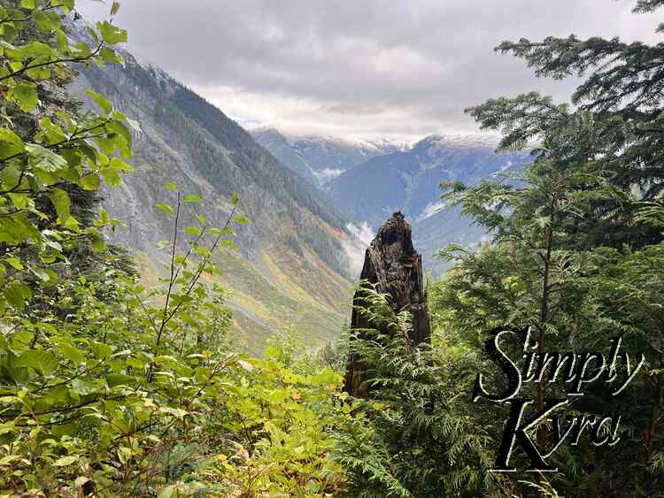
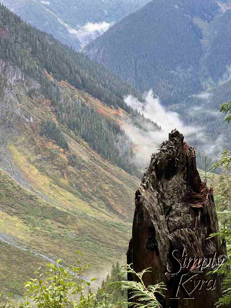
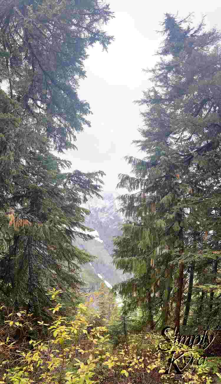
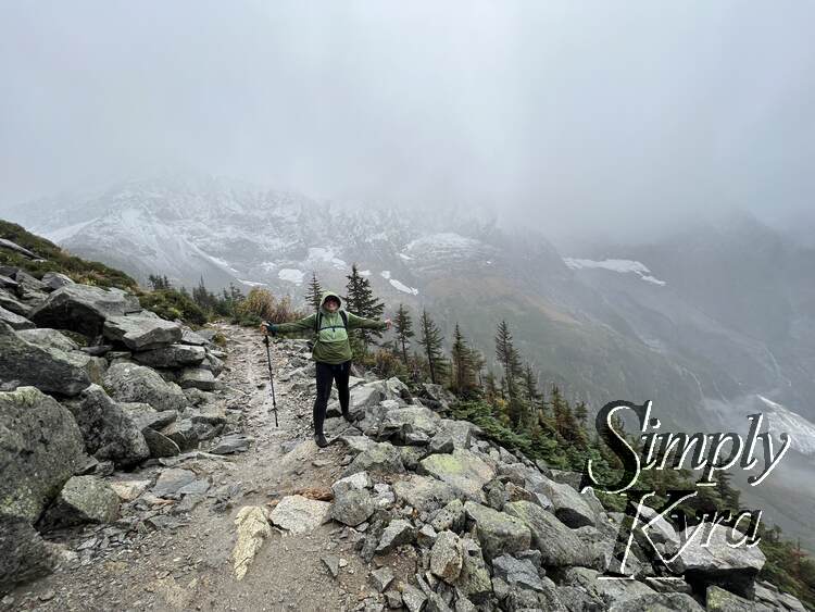
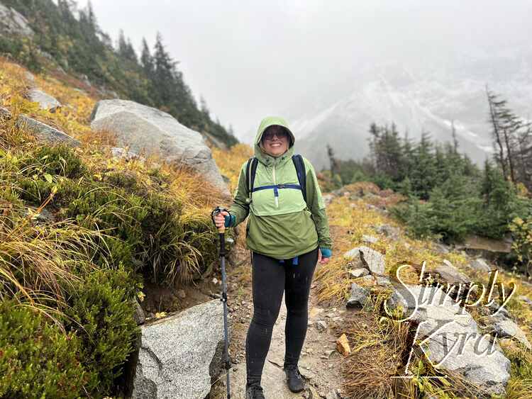
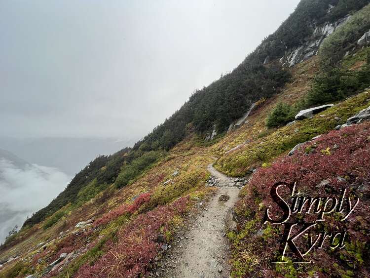
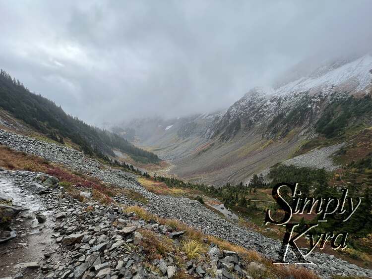
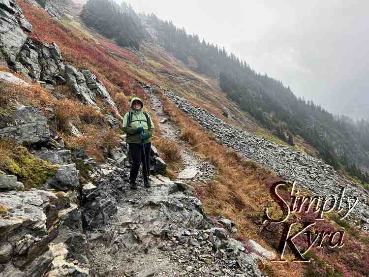
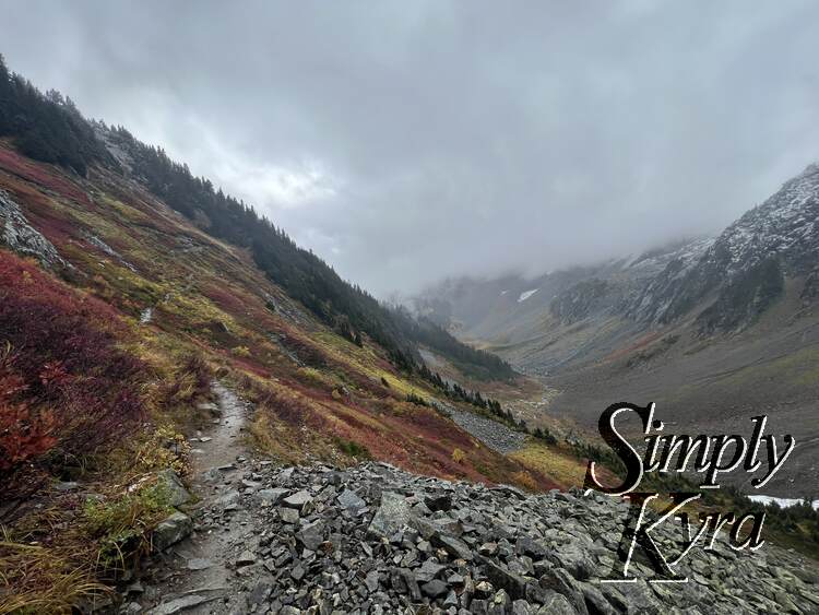
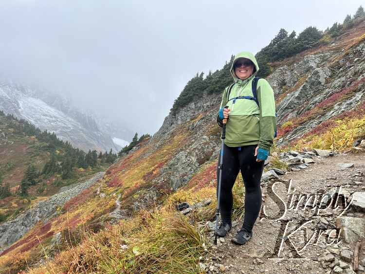
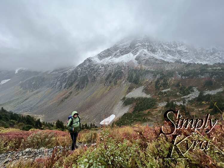
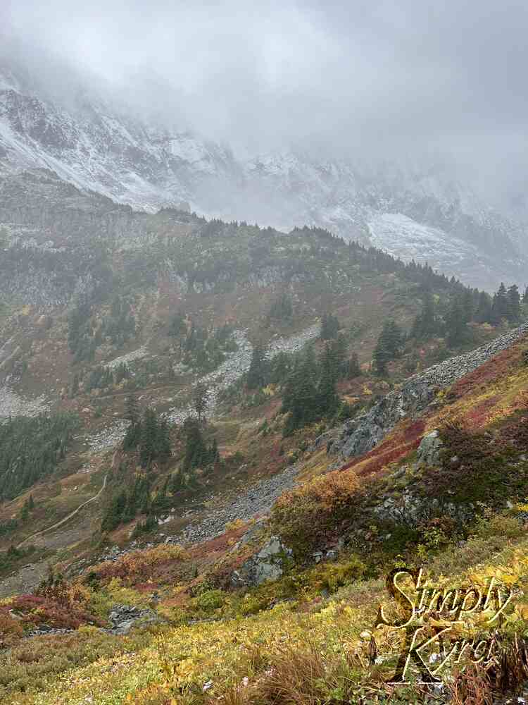
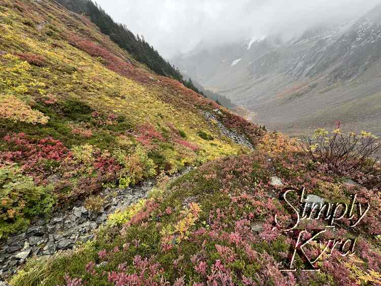
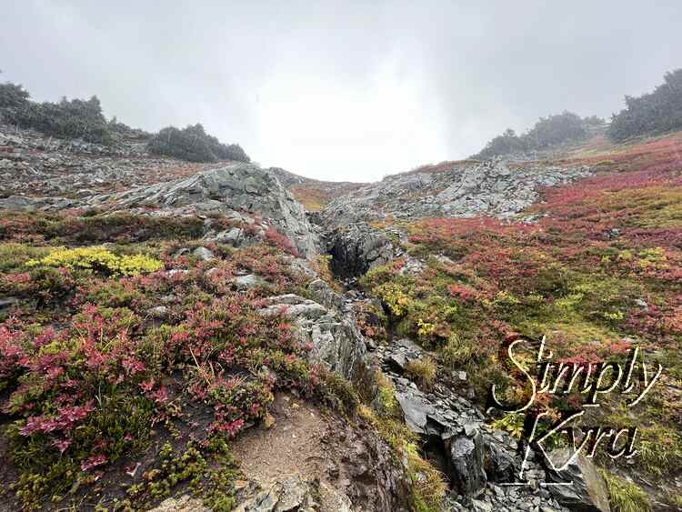
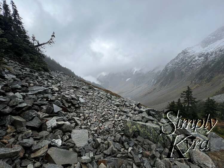
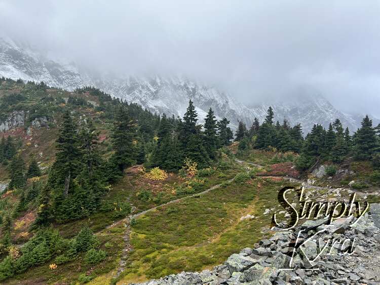
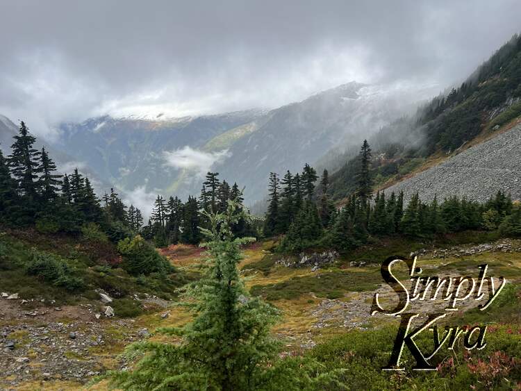
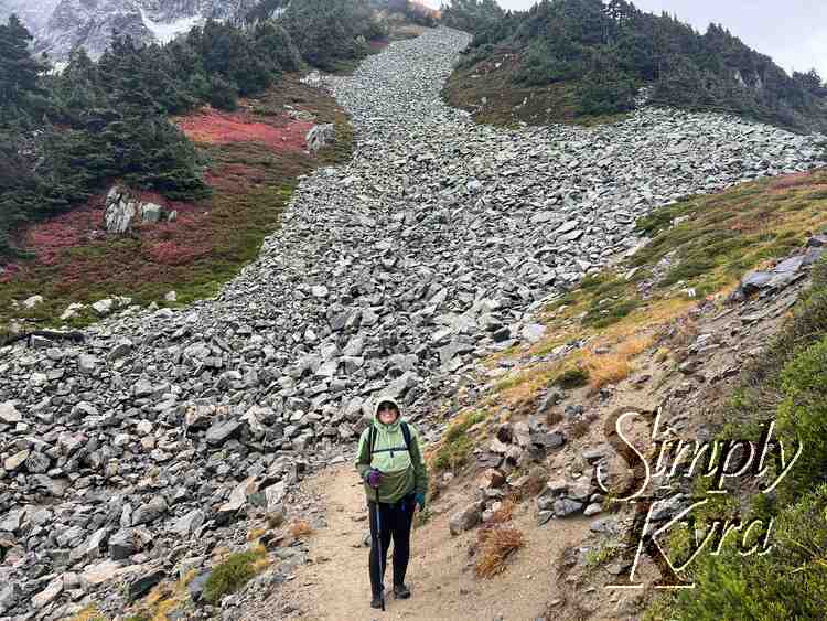
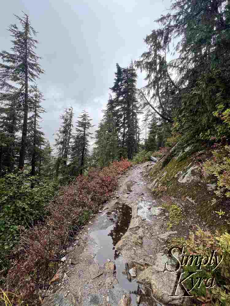
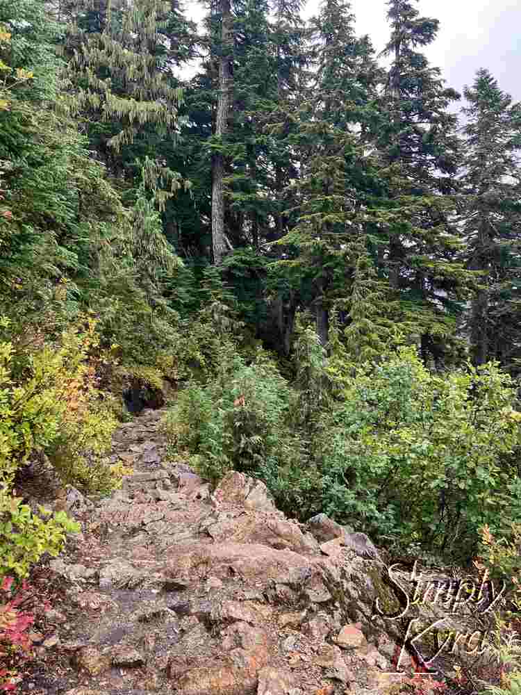
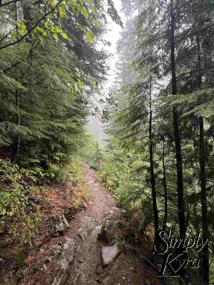
Panorama photo from the parking lot showing the informational posters with the mountains and streams in the background.
Sign at the trailhead listing the trail destinations and distance in miles. Cascade pass is the smallest at 3.7 while Stehekin is the longest at over 30 miles away.

Hiking Up

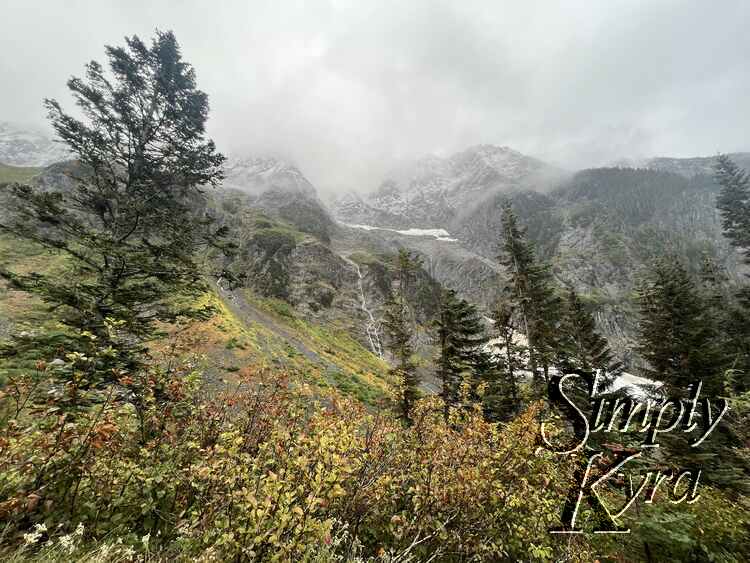
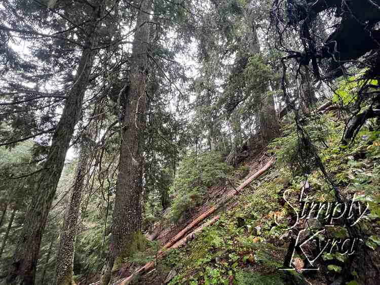
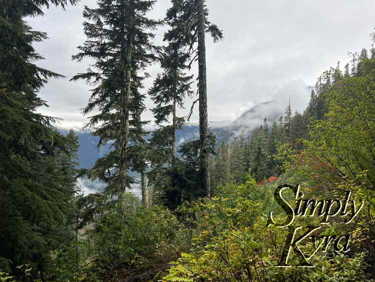
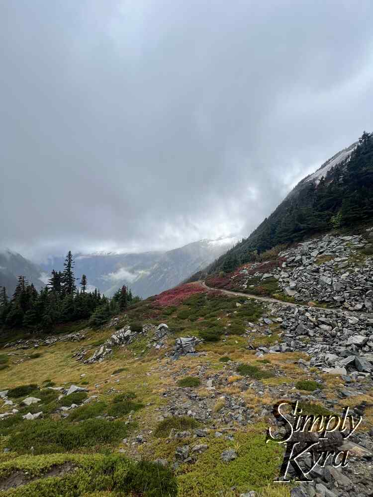
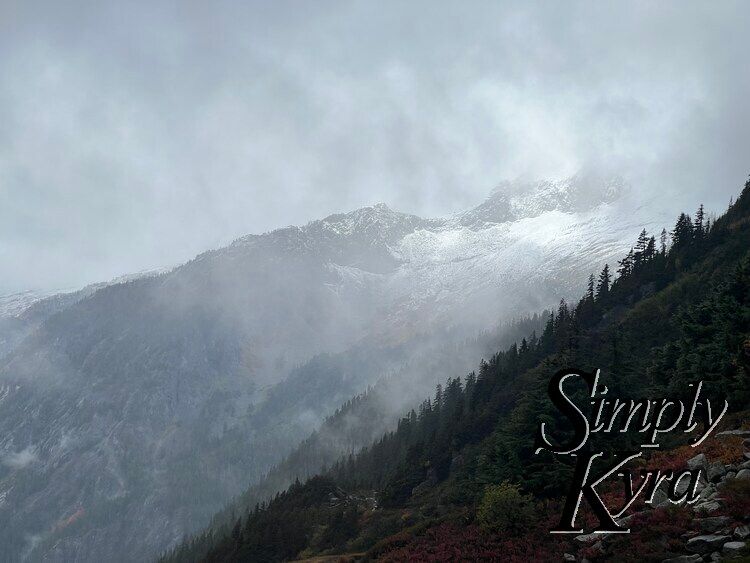
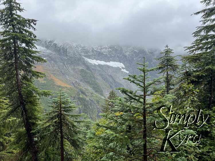
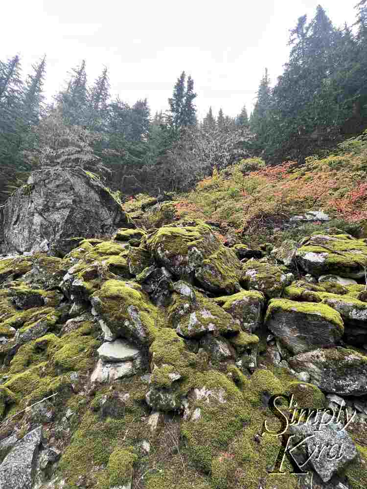
The first 2.7 miles of the hike consisted of about 30 switchbacks before straightening out for the rest of the way. The hike itself goes mostly upward without many downward patches meaning the way back is consistently going down. The trees themselves were so pretty and any breaks between them offered pretty epic views too. As you approached the trail's end the trees thinned out offering a larger vista with minor amounts of fog adding definition to the view.
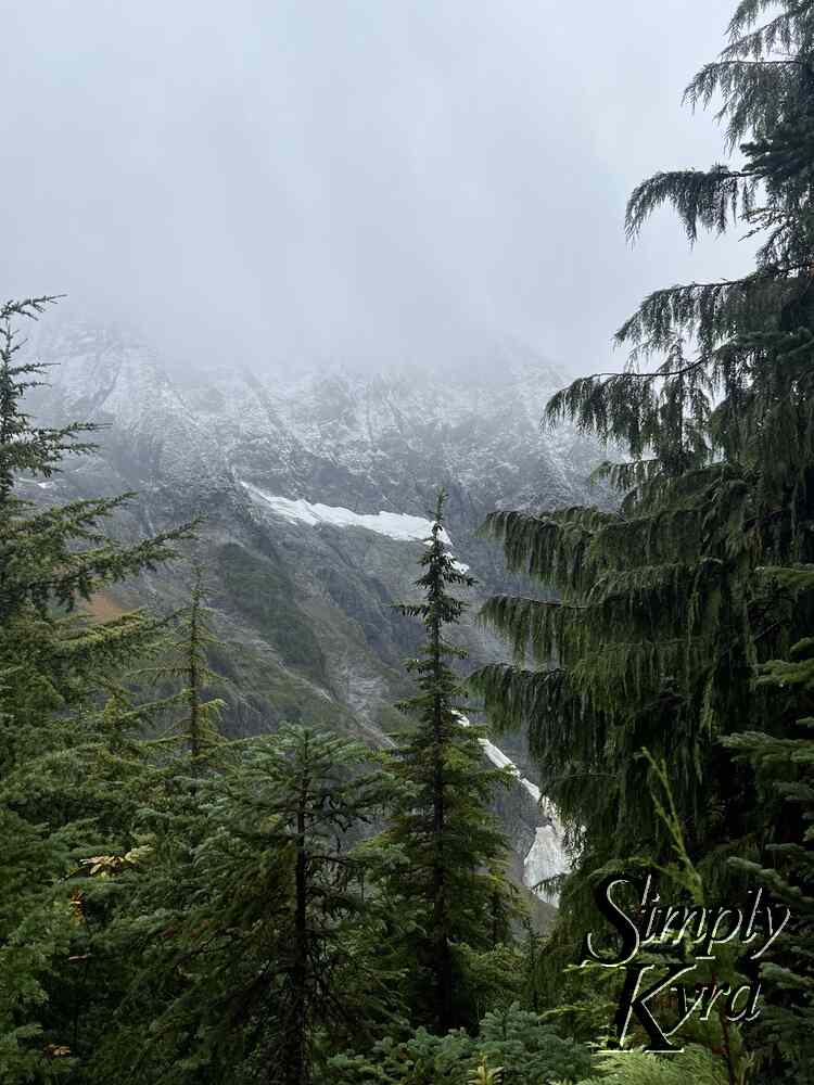
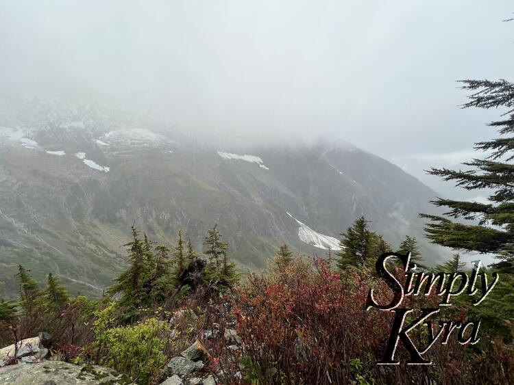
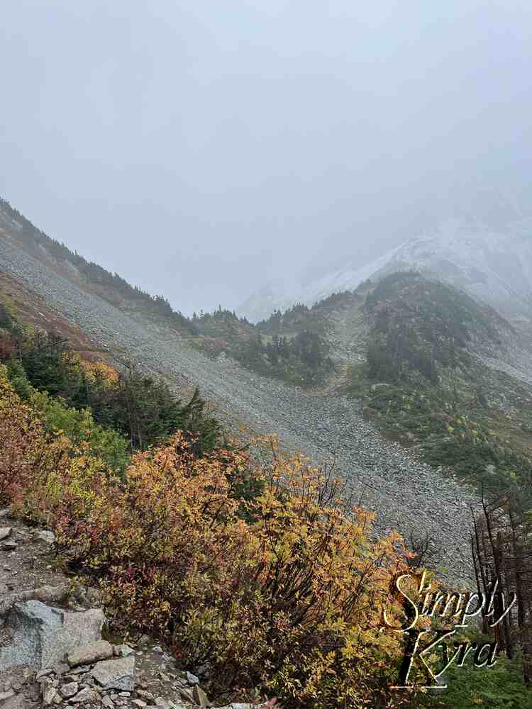
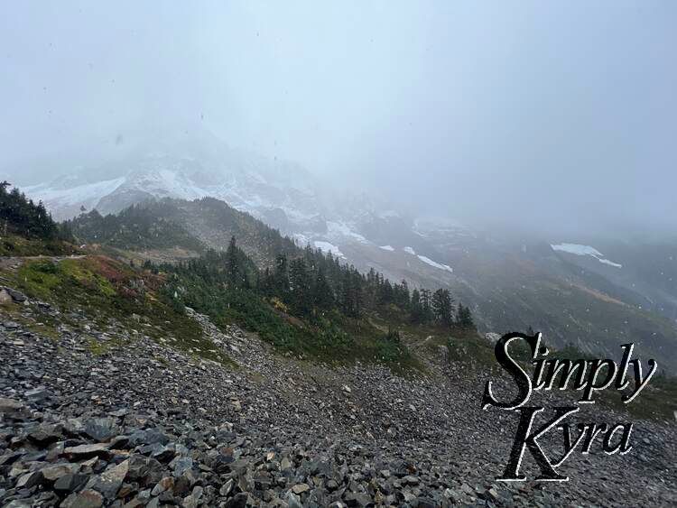
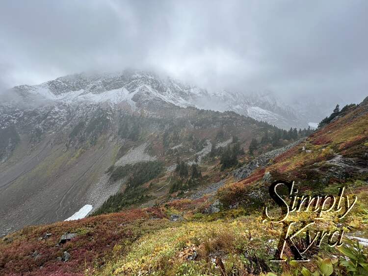
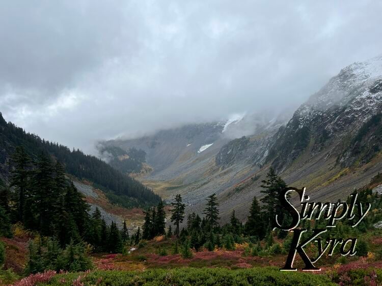
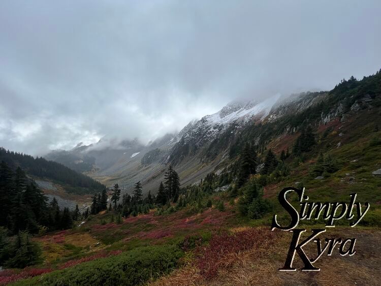
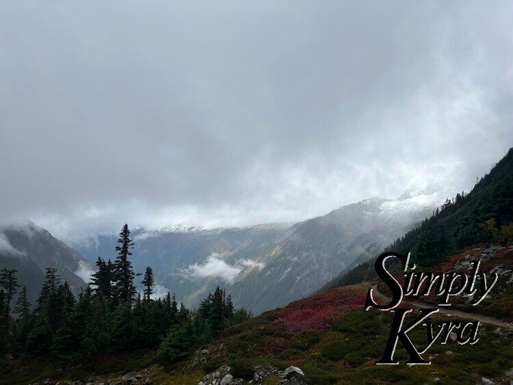
Image shows trees in the foreground with the snow capped mountains in the background.
Image shows a steep hill going up to the right with assorted trees.
Vertical image shows several trees stretching from below to above the image with the mountain in the background.
Image shows a smooth wet log on the patch with trees in the midground with the snow capped mountains in the background.
A root strewn path through the trees.
Image shows a couple trees in the foreground and smaller distanced trees and bushes to the right in the fore and midground. The snow capped mountains remain in the background.
Image shows a couple solitary large trees to the left and smaller trees covering the rest of the foreground with the snow capped mountains in the background.
Image shows trees on the hill to the right in the foreground, hills in the mid ground to the left, and snow capped mountains in the background.
Image shows trees framing the photo to the left, right and bottom. A broken trunk sits to the right center with a view of the mountains in the background.
Closeup of the previous broken log with some branches below and to the right. The mountains and fog in the background make a sort of watercolor background.
Image shows trees in the foreground with the snow capped mountains in the background.
Vertical panorama showing the height of the trees. They're in the right and left of the image with smaller bushes at the bottom and the snow capped mountain faded but showing in the center gap.
Image shows trees in the foreground with the snow capped mountains in the background.
I stand with my arms outstretched along the rocky path with smaller trees along the edge of the hill. Foggy mountains lie behind in the background.
Rocks in the foreground, hilled trees in the mid ground, and glaciers and mountains in the background. The fog highlights the valley between the mountains and the clouds blur the top.
Similar image as previous but now the fog in the valley is the forefront of the piece with the treed hills framing it.
I stand smiling on the dirt path surrounded by yellowed plants and large boulders. The background of foggy mountains and trees is blurred.
Image shows the small path through the talus fields with the mountain in the background and plants in the foreground. If you look closely you can see two specks of orange of two hikers in the distance traversing the rocks.
Image shows a hill along the bottom and rising on the right full of rocks and green, yellow, and red plants. The bright color offsets the white and grey of the mountains, clouds, fog, and glacier in the background.
This image is similar to the before one but is panned a bit out to show more red hued plants along the bottom and grey rocks.
Image shows a grey path on a hill surrounded by green, yellow, and red. The background is greyed out with fog and clouds.
Image shows rocks in the foreground, trees in the mid ground, and snow covered patches poking out from the fog in the background.
Rocks strewn the back of the image with green, yellow, and red patches in the mid ground and trees behind. The background is all shades of grey with glacier, mountains, and fog.
Image shows a hill of green and red with a wet dirt path cutting through. Trees stand to the left and right highlighting the hill height and framing the clouds against the greyed mountainous hazy background.

Trail's End

The vista at the trail's end was so gorgeous! To the left of this view the trail continues on while to the right there are steep steps going up with a sign marking it as a toilet stop. I never went up but I'm now wondering what the view would've been like from there.
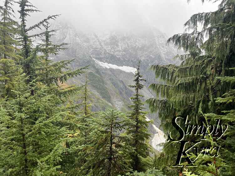
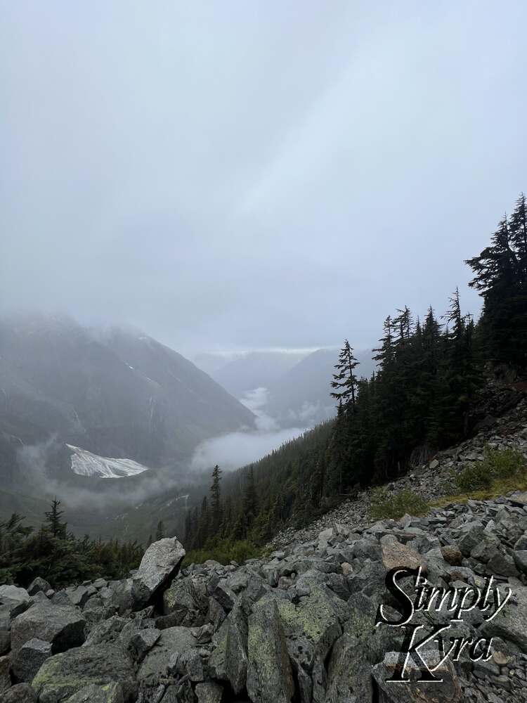
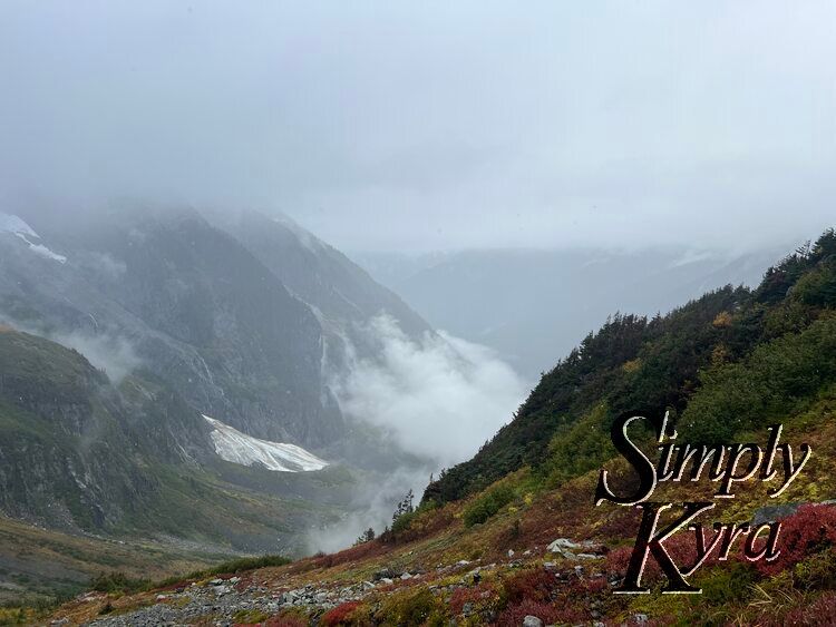
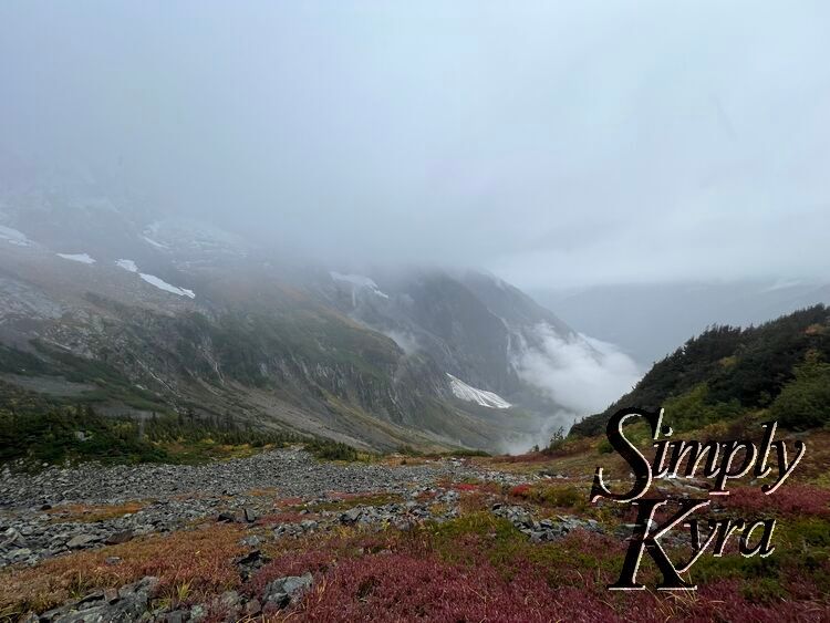
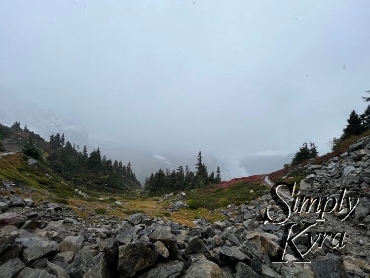
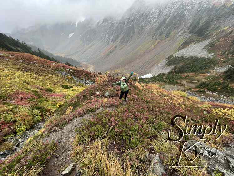
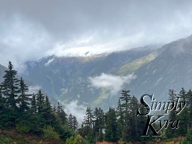
Image shows a colorful vista of yellow, red, and grey with hills of trees, rock, and snow. A path cuts through on the left side.

Beyond the End

If you continue past the end of Cascade Pass Trail you'll next head towards Sahale Arm and Doubtful Lake. We knew we didn't have enough time for Sahale Arm but was told Doubtful Lake wasn't too far and as we weren't that hungry decided to continue on. After marveling at the vista and taking some photos on the way we then decided to turn back before reaching the lake as the rain and slush was picking up and we worried about doing the road back in the dark.

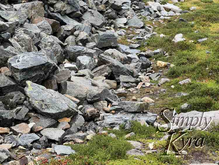
I didn't get a good photo but we heard the calls of the American pikas and saw a couple at the base of the rocks (exact location shown in the last photo in this section) so keep an eye out if you're looking to spot them.

I stand in the center of a rocky path cutting through a field of yellow, red, and green grass and rocks. Trees and talus fields sit behind.
Similar image as before but now highlighting the landscape with the colorful red, yellow, and green against the greys of the clouds and rocks.
Image shows me at the foreground on the dirt path with the colorful hill falling away to the left and climbing on the right. In the background s another small colorful hill and talus to the left and grey of snow, cloud, and mountain in the background.
Image shows a field of green, red, and yellow on the lower quarter of the screen with me standing on a mostly hidden path to the left of it. The rocky hills and snowy mountain stands behind fog strewn.
Vertical panorama showing the yellow fields then red then rock then tree topped hill. Behind it all stands a mountain fog strewn.
Image shows a yellow, red, and green hill slowly stretching to the white and grey mountain.
Image shows a yellow, red, and green hill rising to the left with the grey-ish mountain to the right and clouds roiling in between.
I stand with my arms outstretched and tongue out on the pathway surrounded by colorful hills in red, yellow, and green. In the background is the base of a grey background.
Red, yellow, and green hill with a rocky path along the middle. In the background is a mountainous hill that's fog strewn.
A hil of red, green, yellow, and rock is cut through with a small rippling waterfall.
A hill of rock lays along the left and center of the image with trees to the left and right. In the background sits the snow capped mountain and clouds.
A field of green and yellow is cut through with a path. Rocks sit to the right and trees along the edge. The mountain stands in the background with fog covering the top.
The bottom of the rocks (talus) field lays to the left with the grass to the right. Unseen are the American pikas hiding behind the rocks.

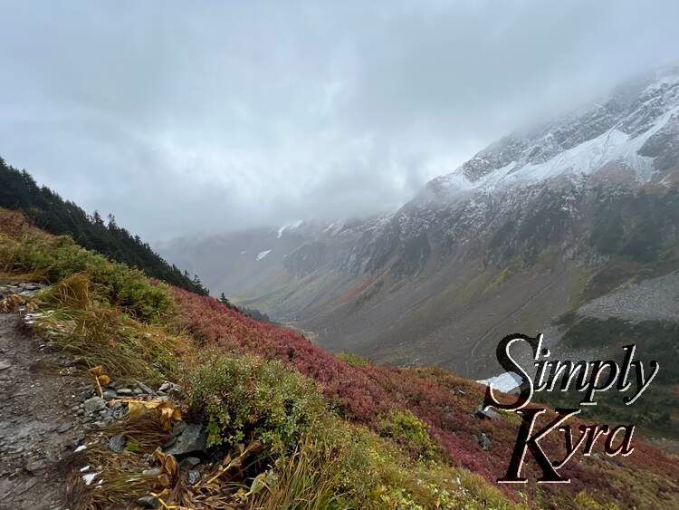
Back at the Trail's End

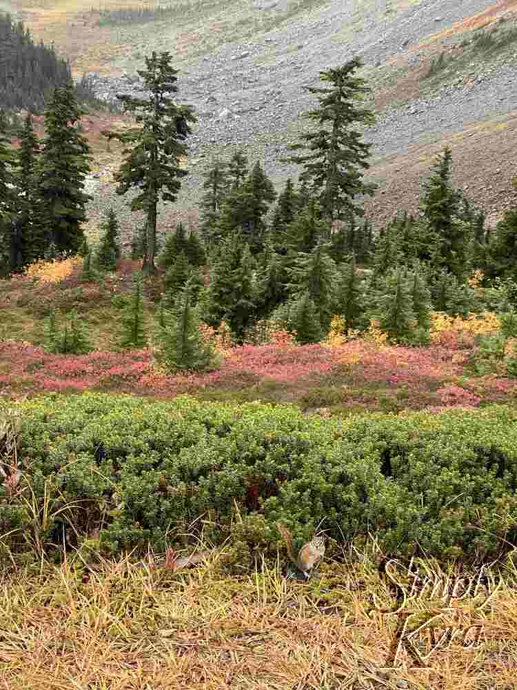
Once back at the trail's end we sat on one of the larger rocks to eat while looking out at this amazing view. Quick word of warning we did see a chipmunk or two scoping out the area so be careful not to share while eating.
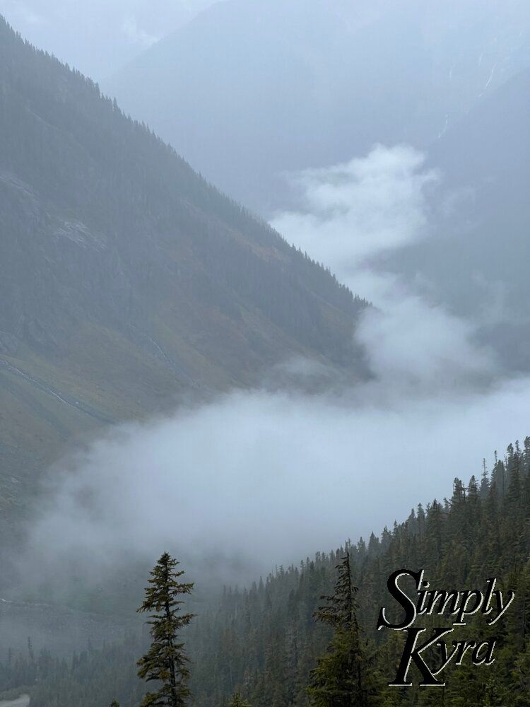
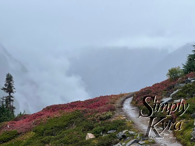
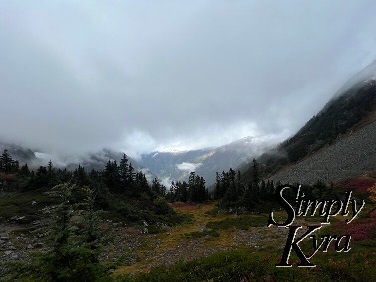
Image shows trees in the foreground in the mid ground, fields of green and red in the foreground, and snow capped mountains in the background.
Vertical image with yellow grass in the front, a single chipmunk, green bushes, red plants, small trees, a few large trees, and fields of rock and grass in the background.
An image slightly darker to highlight the mountain and clouds in the background. In the foreground are the colorful hills of trees and grass.

And Back Again

Like Tolmie Peak before this trail is a "there and back" hike so once we finished eating we headed back down. While at the top the fog had gotten worse so we found ourselves walking into the fog as we went but still found the landscape amazing.
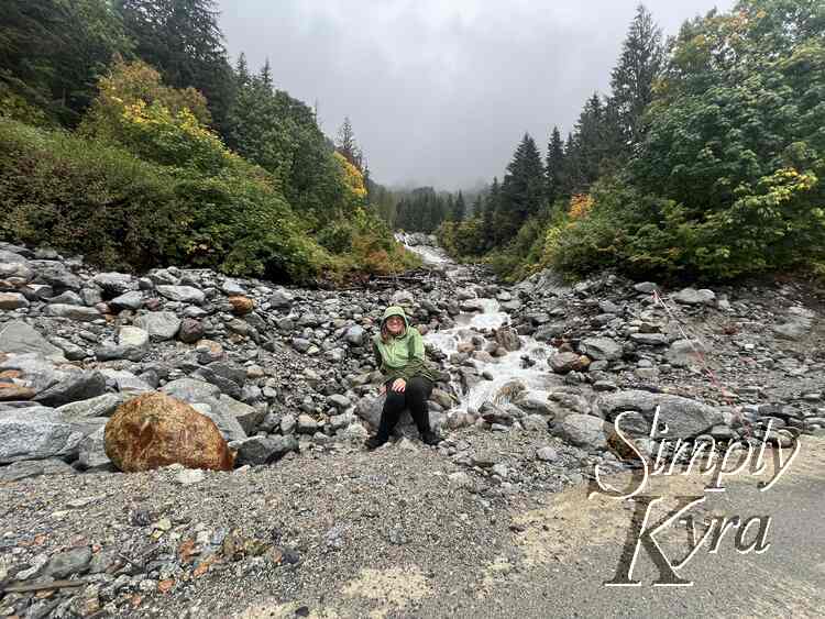
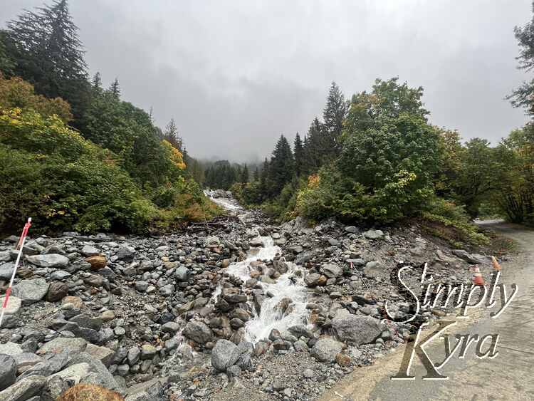
Image shows trees in the foreground with the snow capped mountains in the background.
I stand on the dirt path in front of a talus field with green and red grass behind and green trees.
Image shows a hill of red, green, and yellow with rocks to the right cut through with the path. To the left stand some trees highlighting the foreground from the grey mountainous background.
Image shows a green treed hill rising to the right with layers of treed hils and mountains behind. Each layer is made more obvious by the opacity of the fog in front of it.
Same image as before but panned back to show more trees and the mountains to the left highlighting the look of of the clouds and the red in the hills.
The puddles in the dirt and rock path reflect the trees surrounding it and contrast with the foliage while matching the grey skies.
Image shows trees in the foreground with the snow capped mountains in the background.
The rocky and red-tinged pathway cuts through the green and yellow trees surrounding it.
The tall image highlights the tall trees surrounding the rocky path cutting through it. The fog hides the background from view.
Image shows trees in the foreground with the snow capped mountains in the background.

Drive Out

Once back at the car we headed home but since the road was empty and the fog wasn't quite as bad as we had thought we stopped for photos at the waterfall on the way out the park.
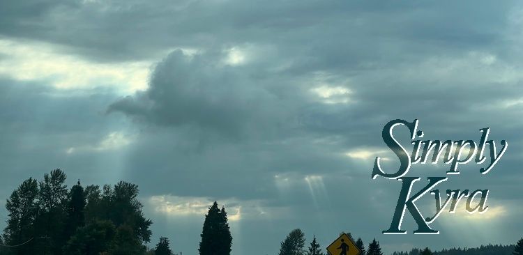
A waterfall and creek burbles over the rocks surrounded by trees in green with hints of yellow and red.
Image is slanted highlighting more of the stream coming after the waterfall. More trees are also shown along the rocky path in mostly green but with hints of yellow and red.
I sit on a rock in front of the creek. The waterfall is behind me with the green trees to either side in the background. In the foreground to the right lays the road.
I turned around to snap a photo of where the water goes with the mountain and fog in the background.
Another view of the stream but this time panned out to see a bit more of the road and the traffic cones lining the edge to help highlight where not to go.
A pile of moss coated rocks with the green and red trees in the background.

And Goodbye

With that both the hike and the scenic part of the drive was over and I bid you adieu on this adventure. I will now leave you with the sun shinning through the clouds... yet another case of sun rays wishing us a good day after our hike just like when leaving the Tolmie Peak Hike.

Image shows the top of trees and a pedestrian sign with clouds above and sunbeams shining through.

I hope all these photos find you well and you're having a great week.


If you’re interested in getting any of my future blog updates I normally share them to my Facebook page and Instagram account. You’re also more than welcome to join my email list located right under the search bar or underneath this post.


Related Posts

Latest Posts